Located Steering south-eastern Algeria away from the country's capital, 400 kilometers where bordered on the north Batna, about 120 km from the north western state of gas 310 kilometers from the north-eastern state of Khenchla me 200 km to the west Djelfa me 277 kilometers south of the valley b 220 km
Biskra sits on a total area of approximately 21671 square kilometers. The municipality has 33 spread over 12 administrative service inhabited by 633 234 thousand people and the population density at a rate of 28 kilometers per inhabitant. The estimated population for 8808 workers of whom 22 902 65 181 in agriculture and in other sectors. It is thus one of the largest southern states.
The topography of the state is composed of disparate elements, where the mountains are stationed in the north and occupies an area of significant and plains stretching to the axis of the east / west and represent the steppes of Eutaih and Aldosn and Yeoh and Tolga and Sidi obstacle and corral the valley and those areas are characterized by deep and fertile soil. The hills are located on the western side of the territory of the state and includes the Departments of boys and Sidi Khaled Jalal covered with depressions southern and eastern regions of the dust of the city and the most important of the Shatt al-Mgheig. In summer the temperature is high during the day. In winter, the weather is mild Brd.tattabr area Alziban fertile region and the cradle of civilization and science, culture and religious center for radiation and Castle immortal in the history of the glorious revolution of November editorial that liberated the nation from the bondage of the colonizer with greetings Hatem Khalifa Baskari
Alziban nicknamed the Bride of the state and the gate of the Sahara. Balkis angry Makethla and Zaagamtaha

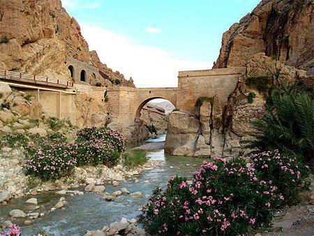
Kantara Municipality and Oasis is located in upstate Biskra, which lies about 54 Km.oha a small town a few quiet Alskan.oha connecting link between the north and south of the center of the Middle Algerian It combines my nature and the hill in the desert climate and geographical nature. Sits on the total surface area of 238.98 km 2, and rising from the Earth's surface a distance of 538.23 m. Established in 1946 as a center of my (decision dated 29 May 1946) and a municipality in the year 1957 (in a decision dated 12 January 1957).

Goofy is a village belonging to the municipality Gsirh circle Tekut mandate of Batna, Algeria, the name of goofy original is flus and naming flus developed in analogy to the nut because the gardens (orchards) goofy reality between two lithofacies, as well as Acorn The section which eat them and the reality between Vlqtin ..... (Avlos Ntljosh) . As goofy naming it for the French military commander Roffey, a village located in the municipality of goofy Gsirh circle Tekut the wilaya of Batna, denied residents goofy twice to Tebessa but returned to their home region after all over


No comments:
Post a Comment